
Central Indiana Floods 2026: Counties Affected, Rescues, and Aid#
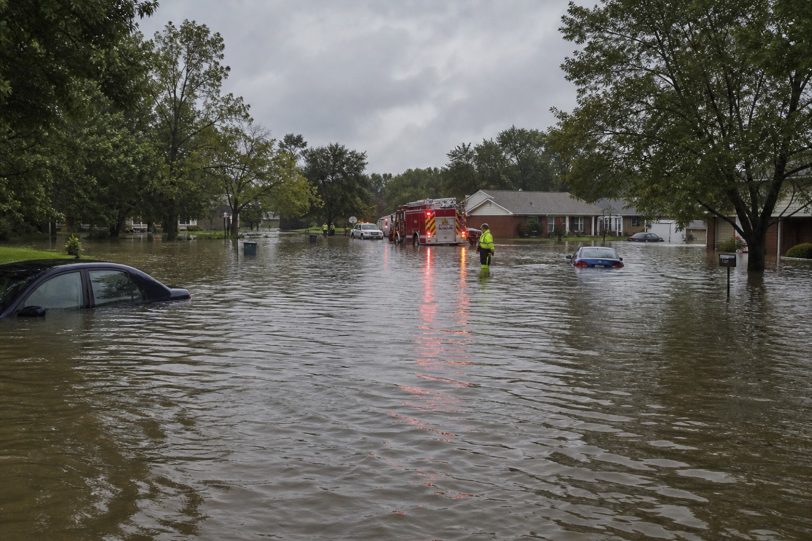
Days of heavy rain, straight-line winds, and flooding that began around August 11, 2026 pushed central Indiana—especially the White River corridor—into a multi-day emergency. By mid-August, officials reported at least six storm-related deaths statewide, large evacuation and rescue counts in the Indianapolis metro, and a presidential emergency declaration covering 53 Indiana counties.
U.S. searches for “central indiana floods,” “flooding in indiana,” and related terms surged as water moved through Hamilton County into Marion County neighborhoods and then farther south. This explainer covers where it hit hardest, what warnings meant, how federal aid works, and practical steps for households dealing with claims paperwork.
What Happened Along the White River#
Forecast offices described major flooding on the White River and moderate flooding on portions of the Wabash. In Hamilton County, the White River crested near 24 feet—more than a foot above flood stage in places near Carmel and Noblesville. Local leaders warned that water would recede slowly and that more rain could stall progress.
Damage and rescues clustered along the river corridor from Hamilton County into northern Indianapolis suburbs. Neighborhoods named repeatedly in briefings included Broad Ripple, Ravenswood, and Rocky Ripple. Indianapolis Mayor Joe Hogsett urged residents along the river to evacuate as managers described rising threats.
By Saturday afternoon reporting, Indianapolis Fire Department spokespersons put rescues around 91 people and 45 pets, with about 400 people evacuating parts of northern Indianapolis on their own. National Guard vehicles joined local crews. Flash-flood watches and warnings rotated across the metro into Sunday morning as storms kept regenerating.
Counties and Communities Under Pressure#
The federal emergency list is long because the storm system was statewide, not a single creek. FEMA announced assistance for counties including (among others):
Allen, Bartholomew, Boone, Carroll, Cass, Clinton, Dearborn, Decatur, Delaware, Fayette, Fountain, Franklin, Fulton, Grant, Hamilton, Hancock, Harrison, Hendricks, Henry, Jasper, Jay, Jefferson, Jennings, Knox, Kosciusko, Lake, LaPorte, Madison, Marion, Marshall, Miami, Morgan, Newton, Orange, Owen, Parke, Perry, Pike, Porter, Pulaski, Randolph, Ripley, Rush, Shelby, St. Joseph, Starke, Tipton, Union, Wabash, Warren, Washington, Wayne, and White.
Local disaster declarations were also reported in places such as Carroll, Dearborn, Delaware, Fayette, Franklin, Hamilton, Henry, Lake, Madison, Marion, Porter, Pulaski, Putnam, Tipton, and Wayne counties, plus cities including Carmel, Noblesville, Attica, Flora, and New Chicago.
Farther south, flooding notes included Bartholomew, Jennings, and Jackson counties, with warnings on rivers such as the Flatrock near Columbus and the East Fork White River. North of Indy, gauges eventually trended down in Marion County while the crest pushed toward Johnson County—good news for some blocks, not a green light for driving flooded roads.
The Human Cost#
Indiana Department of Homeland Security and local agencies linked at least six deaths to the storm period. Public reports included:
- A 4-year-old boy in Jennings County (tree falling on a home in some accounts)
- A 58-year-old woman in Delaware County / Yorktown area, believed to have tried driving through floodwater
- Fatalities reported in Lake, Porter, and LaPorte counties
- An 18-year-old recovered from the Mississinewa River in separate storm-flood coverage
Names and details evolve as coroners confirm. The consistent public-safety message does not: Turn Around, Don’t Drown. Several inches of moving water can float a car. Rescuers repeatedly pulled drivers who underestimated depth.
Delaware County reported more than 350 evacuations. Tipton County evacuated a senior mobile home community. Fayette County ran rescues and welfare checks. Henry County shifted earlier toward cleanup while Hamilton County remained under a local state of emergency with ongoing water rescues.
Federal Emergency Declaration: What It Does#
On August 15, 2026, FEMA announced the President approved an emergency declaration for Indiana for severe storms, straight-line winds, tornadoes, and flooding beginning August 11. The action authorizes FEMA to coordinate federal relief and provide certain emergency protective measures (direct federal assistance) at 75% federal funding under the announcement’s terms.
That is not the same paperwork as every Individual Assistance program homeowners may later seek. Watch for:
- County-by-county designations as damage assessments continue
- State guidance on shelters, sandbags, and boil-water notices
- Insurance deadlines—photograph damage before disposal when it is safe
Darrin Ricketts was named Federal Coordinating Officer in the FEMA release. Designations can expand if the state requests and assessments support it.
Practical Steps If Your Home or Car Was Hit#
- Life safety first — leave if officials order evacuation; never walk or drive into flooded streets.
- Document carefully — photos and short videos of water lines, damaged rooms, and VINs help claims.
- Separate clean dry papers — deeds, IDs, and policies belong in a zip bag above water level.
- Bundle claim PDFs — adjuster letters, inventory lists, and estimates stack up fast.
When those files get scattered across email downloads, Merge PDF builds one claims packet. Compress PDF helps if an insurer portal or Gmail rejects a large attachment. Pull a single page (for example one estimate) with Split PDF instead of re-uploading a full binder.
What Central Indiana Should Watch Next#
- Updated NWS flood warnings for Marion, Hamilton, and Hendricks into the morning hours after crest
- Secondary flooding south of Indianapolis as the pulse moves downstream
- Mold and electrical hazards during re-entry—wait for utility clearance when advised
- Donation scams that spike after every U.S. disaster; verify organizations before sending money or PDFs of personal IDs
FAQ#
Which Indiana areas flooded the worst?#
The White River corridor through Hamilton County into northern Indianapolis (including Broad Ripple, Ravenswood, and Rocky Ripple) saw major impacts, with additional flooding and evacuations across many central and statewide counties.
How many people died?#
Officials reported at least six storm-related deaths across Indiana since the August 11 start of the event; details are updated by local authorities.
Is there federal help?#
Yes. FEMA announced a presidential emergency declaration covering 53 counties for protective measures and coordinated federal support. Check DisasterAssistance.gov and Indiana state emergency pages for the latest individual programs.
Is the water done rising in Indianapolis?#
Gauges in Marion County were reported trending down after the crest moved south, but additional rain and downstream crests can still threaten neighborhoods and roads.
Conclusion#
The 2026 central Indiana floods are a multi-county emergency defined by White River major flooding, large rescue counts in the Indy metro, tragic storm deaths, and broad FEMA coverage. If you are safe, focus next on official warnings and organized paperwork—not rumor. When claim documents pile up, keep them in one clear PDF packet you can actually send.